Cargando...
Recursos educativos
-
Nivel educativo
-
Competencias
-
Tipología
-
Idioma
-
Tipo de medio
-
Tipo de actividad
-
Destinatarios
-
Tipo de audiencia
-
Creador
Lo más buscado
- Actividades día de la paz
- Experimentos con globos
- Seres inertes
- Letras Q
- Actividades eso
- Alimentación saludable en cuarto
- Juegos de tablas de multiplicar sexto
- fichas matemáticas
- Actividades de lógica cuarto
- Animales dibujados
- Actividades de lectoescritura segundo
- Actividad de lectura para primaria
- Arte islamico
- Uso de b y v
- problemas matemáticas
-

True/false. Map reading
EduBook Organización
- 3862 visitas
Indicate whether the following statements about maps are true or false: To successfully read a map we need a scale and a key. Maps use two types of scale: a numeric scale and a graphic scale. The key…
-
Did you know... Industries in Spain
EduBook Organización
- 2864 visitas
Spain's thread and fabric industries are based in Catalonia and the Community of Valencia, while the clothing industry is based mainly in Galicia. The leather and footwear industry is primarily in…
-
Webquest: Winter holidays
Tiching explorer Organización
- 2 lo usan
- 4016 visitas
Resource designed to help us explore different winter holidays that are celebrated by different cultures around the world. We deal with Hanukkah, Kwanza, Diwali, Dong zhi, Christmas. We complete a…
-
Urban growth: One in two 'will live in cities'
Maria Pallarés Docente
-
- 2 lo usan
- 3495 visitas
Report by the BBC about urban growth, quoting data from the report by the United Nations Population Fund entitled “The State of World Population 2007: Unleashing the Potential of Urban Growth”. It…
-
-

The Evolution of the European Union
Tiching explorer Organización
- 3550 visitas
This interactive map of Europe shows the evolution of the European Union (EU) over the years, since 1957 until 2007. The info graphic indicates when the various member states joined, if we drag the…
-
The representation of the Earth: maps
EduBook Organización
- 4033 visitas
2.1. Maps Maps are flat representations of the Earth's surface. To read and interpret a map we need to know its basic elements: scale and conventional signs. Scale Scale indicates how many times the…
-
Four Branches of Earth Science
Tiching explorer Organización
- 5390 visitas
The four branches of Earth Science are Oceanography, Meteorology, Astronomy, and Geology. Students will choose one branch, research how it has changed our lives and then try to persuade the rest of the…
-
Identify. Demographic concepts
EduBook Organización
- 2418 visitas
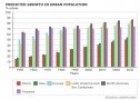
Match each definition with a concept: Graphic representation of the population of a place at a particular moment, in terms of gender and age. Difference between the people who come to live in a place…


Te estamos redirigiendo a la ficha del libro...
