Cargando...
Recursos educativos
-
Nivel educativo
-
Competencias
-
Tipología
-
Idioma
-
Tipo de medio
-
Tipo de actividad
-
Destinatarios
-
Tipo de audiencia
-
Creador
Lo más buscado
- Animales acuáticos
- Actividades educativas para niños cuarto
- Juegos matemáticos
- Letras R
- Guía de fracciones
- Aprender a dibujar
- Experimentos de matemáticas
- Cuentos cortos para dormir
- Experimentos naturales
- Letras S
- actividades educativos
- Carga positiva
- juegos escolares
- Procesos y Medios de Comunicación
- Repaso de GA GO y GU
-
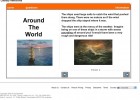
Around the world
Tiching explorer Organización
- 3468 visitas
This lesson we learn about sailing in the past: what ships they used, how stars were used to navigate, what kind of maps they used, the tasks of the crew, etc... There are comprehension questions. We…
-

Wildlife and habitats
Tiching explorer Organización
- 1 lo usan
- 3903 visitas
In this website we find out about animals (amphibians, birds, bugs, dinosaurs, fish, invertebrates, mammals, reptiles) and habitats (antarctic, artic, forest, water, grassland, mountain). There are…
-

What is atmospheric pressure?
EduBook Organización
- 2070 visitas
Air has weight, even though it is very light. The atmosphere is a layer of air. The weight of this air applies pressure on the Earth's surface. Atmospheric pressure is not the same everywhere on the…
-

Anticyclones and depressions
EduBook Organización
- 2062 visitas
Isobars are imaginary lines that appear on weather maps. They connect places with the same atmospheric pressure. Anticyclones are shown by concentric isobars, with high numbers at their centre.…
-

Average annual rainfall
EduBook Organización
- 1981 visitas
Precipitation maps have imaginary lines called isohyets. The isohyets connect places on the Earth's surface with the same amount of precipitation. The map shows how: Precipitation is abundant in…
-
-

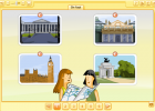
Directions
INTEF Organización
- 2 lo usan
- 2017 visitas
In this unit we ask for and give directions, follow maps, and describe a journey in London. We practice grammar (present perfect, degrees of certainty, modals, third conditional, simple present and…
-
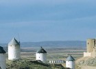
Travel routes in Spain: The Windmills Route. The Toledo area of La Mancha in
V&V Books Vicens Vives Organización
- 1799 visitas
Spain.info in english. Information about the travel route The Windmills Route. The Toledo area of La Mancha in Spain on the official website for tourism in Spain: destinations on the route The Windmills…
-

Learn. Reading a topographic map
EduBook Organización
- 1434 visitas
Topographic maps show the geographical relief of an area. Below is an example map (scale 1:25000) showing Matamorosa in Cantabria. Map reading guide The map key Look at the map key. Only the important…
-

Internet Project
EduBook Organización
- 1382 visitas
In the original version of Gulliver’s Travels, Jonathan Swift printed maps to show where the imaginary islands of Lilliput and Blefuscu were. He did this to make his book seem more realistic. At the…


Te estamos redirigiendo a la ficha del libro...
