Cargando...
Recursos educativos
-
Nivel educativo
-
Competencias
-
Tipología
-
Idioma
-
Tipo de medio
-
Tipo de actividad
-
Destinatarios
-
Tipo de audiencia
-
Creador
Lo más buscado
- Biosfera para tercero
- Lagos de América
- Conocimiento del medio natural, social y cultural
- Actividades de lectoescritura octavo
- Juegos interactivos para niños
- redacción
- Palabras con hie
- Alimentación saludable en segundo nivel
- Actividades musicales segundo nivel
- Actividades cientificas para niños sexto
- Aprender a multiplicar
- Animales terrestres
- Repaso de la multiplicación
- Recetas para niños
- Problemas aditivos y multiplicativos
-
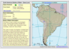
Game: South American bodies of water
Sheppard software Organización
- 1 lo usan
- 2460 visitas
In this game we have to click on to the map the body of water we are asked each time.
-

Describe. Divided Europe
EduBook Organización
- 2248 visitas
Look at the map. Describe the two blocs in post-war Europe. What does the red line mean?
-

Choose. Conventional signs
EduBook Organización
- 2240 visitas
Choose the description of the sign that goes with the element of a map: Rivers Elevation Urban areas Major roads
-
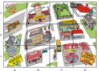
Going to work
Tiching explorer Organización
- 1 lo usan
- 2022 visitas
The resource contains three exercises to help us learn vocabulary associated to jobs. We identify places in a map.
-

Final self-evaluation 06 - The Earth's climate zones
EduBook Organización
- 1994 visitas
Look at the map and match the climate with the correct colour: blue yellow green turquoise pink brown
-
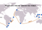
Magellan's Voyage (1519-1522)
Tiching explorer Organización
- 1 lo usan
- 1507 visitas
Resource consisting of a map quiz in which we have to identify and click onto the routes of Magellan's voyages.
-

Look. Population density
EduBook Organización
- 1830 visitas
Refer to the text and give reasons for the variation in population density shown on the map.
-
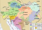
Nationalities of the Austrian Empire
V&V Books Vicens Vives Organización
- 1840 visitas
A map showing all of the different nationalities that lived within the Austrian Empire in 19th century Europe.
-

Analyse. Air traffic
EduBook Organización
- 1652 visitas
Look at the map. Which cities do you think are the most well-connected to a global network?
-

5. Evaluation - The representation of the Earth: maps
EduBook Organización
- 1636 visitas
If the numerical value of a map scale is small, what do we know about the area it represents?
Te estamos redirigiendo a la ficha del libro...


